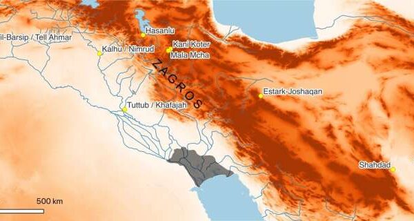


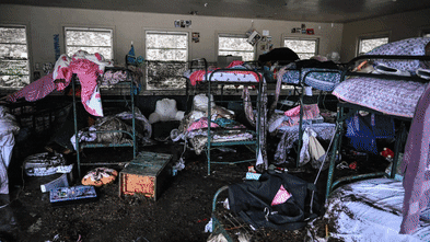


Flash flooding on July 4, 2025, devastated communities in Texas, raising urgent concerns about the effectiveness of the U.S. Federal Emergency Management Agency’s (FEMA) flood risk maps. The incident, particularly severe in areas like Kerrville, highlighted significant shortcomings in the current mapping system that leave many homeowners unprepared for such disasters.
FEMA’s Flood Insurance Rate Maps (FIRMs) are designed to identify areas at risk of flooding. Developed in the 1970s to support the National Flood Insurance Program, these maps determine flood insurance requirements for federally backed mortgages, inform local building codes, and guide land-use decisions. However, as demonstrated by the recent flash floods, these maps do not adequately account for the realities of modern flooding risks.
Limitations of Current Flood Risk Assessments
Despite improvements in data accuracy and community engagement, FEMA’s maps fail to capture the full spectrum of flooding risks, particularly those associated with flash floods caused by intense rainfall. The FIRMs primarily focus on riverine and coastal flooding, excluding smaller waterways such as creeks and tributaries that are vulnerable to sudden, severe flooding.
Research conducted by First Street revealed that more than twice as many properties are at risk of a 100-year flood than FEMA’s maps indicate. For instance, an area around Asheville, North Carolina, experienced significant damage from Hurricane Helene in 2024, affecting properties that FEMA did not classify as high-risk.
Even in mapped areas, such as Camp Mystic in Kerr County, Texas, where the devastating flash flood occurred, reliance on outdated historical data can lead to underestimations of actual flood risks. This reliance on historical patterns, combined with political influences on the mapping process, can compromise the maps’ effectiveness.
The Impact of Politics on Flood Mapping
Political pressures often shape FEMA’s mapping process, causing delays or alterations that can obscure true risks. Local governments and developers may resist high-risk designations to avoid insurance mandates or development restrictions. A notable example is New York City’s appeal against a 2015 update of FEMA’s flood maps, which has left the city relying on maps that are around 20 years old.
The time taken to develop and implement new flood maps averages between five to seven years. This delay can result in outdated assessments that do not reflect current land use or emerging flood risks, particularly in areas increasingly affected by climate change.
As a consequence, infrastructure planning and building codes, which depend heavily on these maps, may fail to address the growing threats posed by extreme weather events. Vulnerable structures could continue to be built in high-risk areas, exacerbating potential losses in future flooding events.
Technological Advances and Future Directions
Recent advancements in technology, including satellite imaging and high-resolution lidar, offer promising solutions for more accurate flood risk mapping. These tools can capture risks associated with extreme rainfall and flash flooding, providing a clearer picture of vulnerabilities in various regions.
However, integrating these technologies into FEMA’s mapping requires substantial federal investment. The challenge remains that updating flood maps has often been politically contentious, as new designations can lead to stricter building codes and increased insurance costs.
Private sector innovations have started to fill the gaps left by FEMA. Real estate platforms like Zillow and Redfin now offer property-level flood risk assessments that incorporate climate data, sea-level rise, and changing storm patterns. These models identify risks not covered by FEMA maps, revealing vulnerabilities in communities across the United States.
As awareness of climate-related risks grows, property buyers increasingly consider flood risks in their decisions. This shift could influence property values, community tax revenues, and even population migration patterns.
The federal government plays a critical role in ensuring that communities have access to reliable flood risk assessments. As new tools and models emerge, it is essential for FEMA’s flood maps to evolve to reflect current realities and better protect homeowners and communities from the growing threat of flooding.