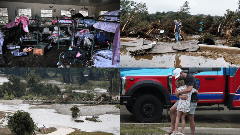
Destructive flash flooding in Texas has raised significant concerns regarding the effectiveness of the U.S. Federal Emergency Management Agency’s (FEMA) flood maps. On July 4, 2025, a deadly flash flood swept through Hunt, Texas, causing extensive damage and highlighting the limitations of these maps in accurately predicting flood risks.
FEMA’s flood maps, known as Flood Insurance Rate Maps (FIRMs), serve as the primary tool for identifying flood risks across the United States. Developed in the 1970s, these maps are essential for determining flood insurance requirements for federally backed mortgages, shaping local building codes, and guiding floodplain management strategies. Despite improvements in accuracy and accessibility over the years, including enhanced data and community input, significant gaps remain.
One critical limitation of FEMA’s maps is their failure to adequately account for flash flooding, particularly in smaller waterways such as streams and creeks. The focus of these maps tends to be on river channels and coastal flooding, leaving many areas vulnerable to risks that are not reflected in the current data. For instance, during the flash flood in Kerrville, Texas, the Guadalupe River rose over 30 feet, but the maps did not fully capture the extent of the risk in that area.
Research conducted by First Street, an organization dedicated to quantifying climate risk, reveals that more than twice as many properties are at risk of a 100-year flood compared to what FEMA’s maps indicate. This discrepancy is particularly concerning as climate change continues to alter rainfall patterns, leading to more frequent and intense downpours.
Political Pressures and Delays in Map Updates
FEMA’s mapping process is often influenced by local political pressures. Local governments and developers may resist high-risk designations to avoid insurance mandates or restrictions on development. This can result in maps that do not accurately reflect the actual risks faced by communities. For example, New York City’s appeal of a 2015 update to FEMA’s flood maps has left the city relying on outdated data, with maps that are approximately 20 years old.
The process of developing and implementing new flood maps can take an average of five to seven years, resulting in many outdated maps across the U.S. These delays affect building codes, infrastructure planning, and flood mitigation efforts, allowing vulnerable structures to be constructed in high-risk areas.
Advancements in Flood Mapping Technology
Technological advancements, such as satellite imaging, rainfall modeling, and high-resolution light detection and ranging (lidar), offer opportunities to create more accurate flood maps that account for extreme rainfall and flash flooding. However, implementing these tools requires substantial federal investment. Congress controls FEMA’s mapping budget and sets the legal framework for map creation, often making updates an unpopular topic among elected officials.
In recent years, the rise of climate risk analytics and private flood risk data has allowed various industries, including real estate and finance, to rely less on FEMA’s maps. These new models incorporate forward-looking climate data, including projections of extreme rainfall and sea-level rise, which FEMA’s maps generally exclude. Real estate platforms such as Zillow and Redfin now provide property-level flood risk assessments based on both historical flooding and future climate projections.
As awareness of flood risks increases among homebuyers, there may be shifts in property desirability that could impact valuations, community tax revenue, and migration patterns. While new data can change perceptions, the underlying risks remain.
The federal government plays a crucial role in ensuring that communities have access to accurate risk assessments. As innovative tools and models for assessing flood risk continue to evolve, it is imperative that FEMA’s mapping systems are updated to reflect these changes.


