


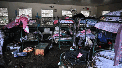


Severe flash floods, such as the one that struck on July 4, 2025, in Hunt, Texas, have raised significant concerns about the effectiveness of the U.S. Federal Emergency Management Agency’s (FEMA) flood maps. These maps, which serve as the primary tool for identifying flood risks nationwide, have been criticized for not accurately reflecting the dangers posed by flash floods, leaving homeowners and communities vulnerable.
FEMA’s Flood Insurance Rate Maps (FIRMs) were first developed in the 1970s to support the National Flood Insurance Program. These maps are crucial for determining where flood insurance is mandatory for federally backed mortgages and for informing local land-use decisions and flood management strategies. A recent incident in Kerrville, Texas, where the Guadalupe River rose over 30 feet during a flash flood, starkly illustrates the shortcomings of these maps.
While FEMA has made strides in improving the accuracy and accessibility of these maps through better data and community feedback, they still fail to capture the full spectrum of flood risks, particularly in light of climate change. Areas that flood frequently may not appear on FEMA’s maps, leaving residents unaware of their vulnerability.
Research from First Street, an organization that quantifies climate risk, highlights this issue. A 2023 assessment revealed that more than twice as many properties across the U.S. are susceptible to a 100-year flood than FEMA’s maps indicate. Even in areas identified as at risk, such as Camp Mystic in Kerr County, Texas, the reliance on historical data can lead to underestimations of flood hazards.
Limitations of Current Flood Mapping
The effectiveness of FEMA’s maps is significantly hampered by their failure to address flash flooding caused by intense rainfall. These maps primarily focus on river and coastal flooding, largely ignoring risks associated with smaller waterways like streams and creeks. This oversight is especially critical as climate change contributes to more frequent and severe rainfall events, increasing the potential for flooding in previously unmapped areas.
For instance, in 2024, flooding from Hurricane Helene inflicted severe, uninsured damage in regions around Asheville, North Carolina, which were not represented on FEMA’s maps. The deadly flash flood that impacted Kerr County on July 4, 2025, further exemplifies how historical data can misrepresent current risks, potentially leading to tragic outcomes.
Political Influences and Delays in Mapping Processes
Political dynamics also play a role in the accuracy of FEMA’s flood maps. Local governments and developers often lobby against high-risk designations to circumvent insurance mandates and development restrictions. This pressure can result in maps that underestimate actual risks, leaving residents unaware of their true exposure.
New York City serves as an example of this issue. The city’s appeal of a 2015 update to FEMA’s Flood Insurance Rate Maps has left its flood risk assessments outdated by approximately 20 years. The lengthy process of updating these maps, which typically takes five to seven years, means many areas across the U.S. rely on data that fails to reflect current conditions or threats from extreme weather.
Outdated maps have serious implications for building codes and infrastructure planning. Local governments depend on these maps to guide construction standards and flood mitigation projects. Consequently, continued reliance on outdated data can lead to the development of vulnerable structures in areas increasingly at risk of flooding.
Advancements in technology, such as satellite imaging and high-resolution lidar, offer promising solutions for creating more accurate flood maps that account for extreme rainfall and flash flooding. However, substantial federal investment is necessary to fully integrate these tools into FEMA’s mapping processes. Congress controls FEMA’s mapping budget, and historically, updating flood maps has not been a priority for many elected officials due to the potential for new flood designations to trigger stricter building codes and increased insurance costs.
Recent developments have seen the rise of climate risk analytics and private flood risk data, which allow industries such as real estate and finance to move beyond FEMA’s maps. These new models incorporate forward-looking climate data, including projections for extreme rainfall and changing storm patterns, which FEMA’s maps generally do not consider. Real estate platforms like Zillow and Redfin now offer property-level flood risk scores that highlight vulnerabilities not captured by FEMA’s maps.
As awareness of flood risks grows among homebuyers, property desirability may shift, leading to broader implications for property values, community tax revenues, and migration patterns. While the emergence of new data may alter public perception, the underlying risks have always existed—they are simply becoming more visible.
The federal government has a critical role in ensuring accurate risk assessments are available to communities nationwide. As new tools and models for assessing flood risk develop, FEMA’s flood maps must evolve to meet the challenges posed by a changing climate. The need for timely and accurate risk assessments has never been more urgent.