


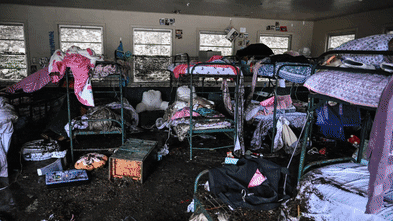


A devastating flash flood struck Hunt, Texas, on July 4, 2025, claiming lives and causing extensive damage to homes, including that of resident Nancy Callery. This incident has ignited scrutiny over the effectiveness of the U.S. Federal Emergency Management Agency’s (FEMA) flood maps, which many argue fail to adequately represent the risks posed by flash floods.
FEMA’s flood maps, officially known as Flood Insurance Rate Maps (FIRMs), were developed in the 1970s to assist with the National Flood Insurance Program. These maps are crucial for determining flood insurance requirements for federally backed mortgages and guiding local building codes and floodplain management strategies. They categorize areas based on the likelihood of flooding, designating regions with a 1% annual chance of flooding in blue and those with a 0.2% chance in tan.
Despite improvements in the accuracy and accessibility of these maps, including enhanced data and community feedback, significant gaps remain. For instance, many areas that frequently experience flooding are absent from the maps. Research conducted by First Street, an organization dedicated to quantifying climate risk, indicates that the risk of a 100-year flood is twice as high in many regions across the country than what FEMA maps suggest.
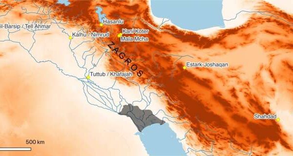
One major criticism of FEMA’s mapping process is its reliance on historical data. The maps primarily focus on river channels and coastal flooding, neglecting the risks associated with intense rainfall and flash floods that can occur in smaller waterways like creeks and streams. As climate change increases the frequency of extreme weather events, the limitations of these maps become increasingly apparent.
For example, in 2024, Hurricane Helene caused significant damage in areas around Asheville, North Carolina, that were not included in FEMA’s flood risk assessments. Even in mapped locations, such as the Camp Mystic site in Kerr County, Texas, the risks may be underestimated due to outdated data.
Political influences further complicate the mapping process. Local governments and developers often resist high-risk designations to avoid triggering insurance mandates or development restrictions. This has resulted in maps that may misrepresent actual flood risks, leaving communities unaware of their vulnerabilities. A notable case is New York City’s protracted appeal regarding its 2015 FEMA flood map update, which has left the city relying on maps that are nearly two decades old.
On average, it takes between five to seven years to develop and implement a new FEMA flood map. Many existing maps do not reflect current land use or urban development, which can lead to the construction of vulnerable structures in flood-prone areas. This delay has significant implications for local building codes and infrastructure planning, as communities depend on these maps to guide safety standards and flood mitigation efforts.
Advancements in technology offer hope for improving flood risk mapping. Innovations in satellite imaging, rainfall modeling, and high-resolution lidar can facilitate the creation of faster and more accurate maps that account for flash flooding and extreme rainfall. However, the integration of these technologies requires substantial federal investment.
FEMA’s budget for mapping is controlled by Congress, and discussions about updating flood maps often lack urgency, as new designations may lead to stricter building codes and higher insurance costs. In recent years, the emergence of climate risk analytics and private flood risk data has enabled the real estate and insurance sectors to supplement FEMA’s maps. These models take into account future climate projections such as extreme rainfall and rising sea levels—factors generally excluded from FEMA’s assessments.
Real estate platforms like Zillow and Redfin now provide property-level flood risk scores based on both historical data and future climate scenarios. This shift towards data-driven property buying decisions could influence real estate trends, valuations, and even community demographics.
As awareness of flood risks grows, the desirability of certain locations may shift, with broader implications for property values and local revenues. While the emergence of new data may seem like a change, the underlying risks have always existed. What is evolving is the understanding of these risks.
The federal government must play a proactive role in ensuring that communities have access to accurate risk assessments. As technological advancements continue to develop, it is crucial that FEMA’s flood risk maps evolve to reflect the realities of a changing climate.