


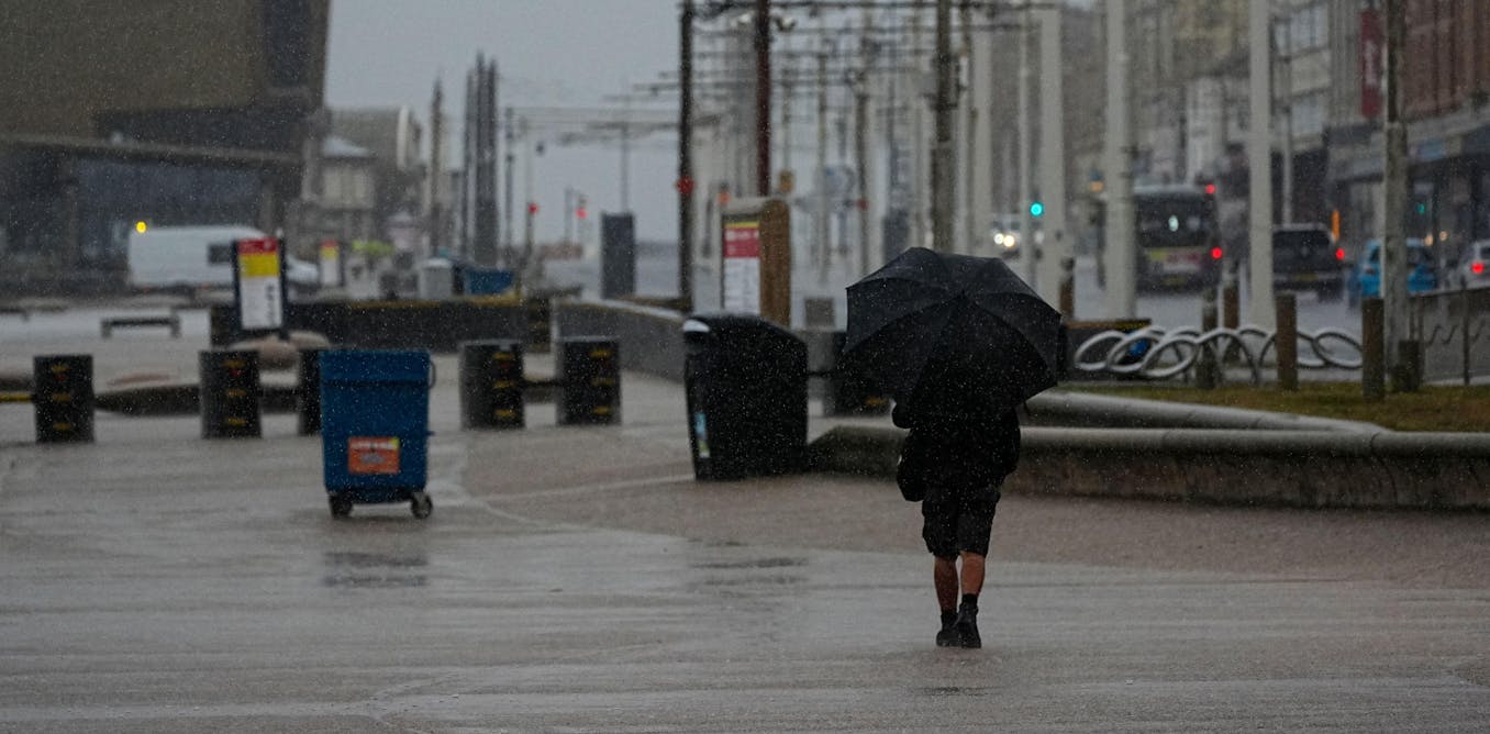
Storm Floris made landfall in northern parts of the UK on the morning of August 4, 2025, unleashing heavy rainfall and severe winds throughout the day. The Met Office issued an amber weather warning for much of Scotland, alongside yellow alerts for Northern Ireland and northern England. Residents in affected areas should prepare for rainfall averaging between 20mm and 40mm, with some regions in Scotland potentially receiving as much as 80mm. Wind speeds in elevated locations could reach between 80mph and 90mph, while gusts across much of Scotland are forecasted to be between 50mph and 60mph.
The storm’s most concerning feature is the atypically strong winds for August, a month usually associated with milder weather. This unusual timing raises the risk to the public, as many individuals are outdoors for holidays or camping. Additionally, trees are in full leaf, making them more susceptible to being uprooted by high winds.
Authorities expect significant disruptions to transport and power networks due to falling trees. Recent research indicates an increased likelihood of large-scale power outages during summer windstorms. Debris from fallen trees could obstruct drainage systems, leading to localized flooding. Persistent strong winds will combine with heavy rainfall during the amber alert, set to expire at 23:00, complicating conditions for emergency responders and potentially delaying access to blocked areas.
Understanding Storm Floris
Storm Floris exhibits characteristics typical of a mid-latitude storm, which usually develop from sharp temperature contrasts between the northern and southern Atlantic Ocean. These storms intensify under the influence of a strong jet stream—a fast-moving air current high in the atmosphere that often directs storms towards the UK. Such conditions are less common during the summer months, when warmer ocean temperatures tend to weaken these contrasts, pushing them northward towards polar regions.
Despite this, storms have occurred in August before. Notable examples include Storm Ellen, which caused extensive damage to electricity infrastructure in Ireland, prompting the Irish Meteorological Service to issue red and amber weather warnings. Other August storms have previously disrupted events like the Boardmasters music festival in Cornwall in 2019 and forced the closure of stages at the Leeds festival in 2024.
Storm Floris is classified as a Shapiro-Keyser cyclone, characterized by a warm core surrounded by colder air. This structure is evident in the storm’s frontal system, which wraps around its center, forming a comma shape in the clouds. Such storms are responsible for some of the most damaging wind events in the UK, featuring sharp pressure gradients and strong low-level airflows. The cold jet, or cold conveyor belt, can generate severe surface winds, although satellite imagery suggests that Floris is unlikely to produce a sting jet—an intense narrow stream of rapidly descending air.
The Future of Storms Like Floris
Research indicates that climate change will influence storm characteristics, although the effects will not be uniform across all aspects. Warmer temperatures are expected to lead to wetter storms, as increased atmospheric moisture enhances rainfall, particularly along frontal systems. Nonetheless, projections regarding wind extremes remain uncertain.
Climate models suggest a modest intensification of winter storms in the UK, while summer storms may become less frequent. This shift is largely attributed to anticipated changes in Atlantic temperature gradients and jet stream behavior. However, many long-term climate projections rely on lower-resolution models that often overlook critical features that drive storm intensification, such as the Gulf Stream and mechanisms responsible for extreme winds.
Higher-resolution models, like those employed for real-time forecasting during Storm Floris, predict more intense winter windstorms in a warming climate, largely due to stronger cold jets and an increase in storms that produce sting jets.
While Storm Floris does not originate from tropical cyclones, many summer and autumn storms impacting the UK stem from such systems, including hurricanes. These storms are often poorly represented in lower-resolution climate models, yet they play a significant role in Europe’s most severe windstorms. The complexity of assessing storm risks remains a subject of ongoing research.
For those seeking a deeper understanding of climate change and its implications, a weekly roundup is available via email, offering insights into specific climate issues.