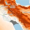


On July 4, 2025, a devastating flash flood struck Hunt, Texas, affecting Nancy Callery’s childhood home and highlighting significant flaws in the nation’s flood mapping system. The U.S. Federal Emergency Management Agency (FEMA) has faced scrutiny for its Flood Insurance Rate Maps (FIRMs), designed to identify areas at risk of flooding. Despite advancements over the years, these maps often fail to account for the unpredictable nature of flash floods, leaving many homeowners unprepared for such disasters.
FEMA’s FIRMs were developed in the 1970s to support the National Flood Insurance Program. They are intended to guide homeowners, businesses, and local officials in understanding flood risks, which in turn influences insurance requirements, building codes, and land-use decisions. However, recent flash floods in Texas and other states have raised questions about the reliability of these maps. For instance, during the July 2025 flash flood, the Guadalupe River in Kerrville rose more than 30 feet, yet many areas were not adequately represented in FEMA’s flood risk assessments.
Research conducted by First Street, a climate risk analysis organization, found that the actual number of properties at risk of a 100-year flood is more than double what FEMA’s maps indicate. Their 2023 assessment utilized newly modeled flood zones alongside climate-adjusted precipitation data, revealing stark discrepancies in flood risk representation across the country. Even in regions identified as at risk, such as the Camp Mystic site in Kerr County, historical data reliance has resulted in underestimations of current flood threats.
One of the primary shortcomings of FEMA’s maps is their limited focus on flash flooding, which is often caused by intense bursts of rain. These maps tend to prioritize river channels and coastal flooding, neglecting smaller waterways like streams and creeks. This oversight is increasingly concerning due to climate change, which is leading to more frequent extreme weather events. The flooding from Hurricane Helene in 2024, which impacted areas around Asheville, North Carolina, exemplified the dangers posed by unmapped regions, resulting in substantial uninsured damages.
Political dynamics further complicate FEMA’s mapping process. Local governments and developers sometimes resist high-risk designations to avoid insurance mandates and restrictions on development. For example, New York City has faced significant delays in updating its flood maps due to ongoing appeals regarding a 2015 FIRMs revision. This delay leaves the city reliant on maps that are nearly two decades old.
The process of creating and updating FEMA’s flood maps can take five to seven years, often leaving them outdated and unreflective of current land use and flood risks. Consequently, many local governments base their infrastructure planning and building codes on insufficient data, potentially allowing vulnerable structures to be constructed in high-risk areas.
Advancements in technology, such as satellite imaging and high-resolution lidar, present opportunities for more accurate flood mapping that accounts for flash floods and extreme weather. However, integrating these technologies requires considerable federal investment. As Congress controls FEMA’s mapping budget, the topic of updating flood maps often falls victim to political disinterest. New flood designations can lead to heightened building codes and insurance costs, making it a contentious issue for many elected officials.
In recent years, the rise of private flood risk data and climate analytics models has allowed industries like real estate and insurance to create their own assessments that often reveal risks overlooked by FEMA. Websites such as Zillow, Redfin, and Realtor.com now provide flood risk scores for properties, incorporating both historical data and future climate projections. This shift in available information is influencing property-buying decisions as buyers become more aware of flood risks.
The implications of these developments are far-reaching. As property buyers consider flood risks more seriously, potential shifts in desirability for certain locations could affect property values, community tax revenues, and migration patterns. The awareness of existing risks has increased, but the underlying dangers remain unchanged.
The federal government plays a crucial role in ensuring accurate risk assessments are accessible to all communities. As new tools and models for assessing flood risks continue to evolve, it is imperative that FEMA’s mapping system adapts accordingly. Addressing these challenges will be essential to safeguarding communities against the growing threat of flooding.