


The NSW Rural Fire Service (RFS) has officially updated the Bush Fire Prone Land (BFPL) map for the Gunnedah Shire, replacing a previous version that was certified in 2003. This updated map has been prepared in line with the Guide for Bush Fire Prone Land Mapping and has received certification from the Commissioner of the NSW RFS under Section 10.3 of the Environmental Planning and Assessment Act 1979. With immediate effect, the new map will be utilized for development control and strategic planning initiatives within the shire.
According to Blake O’Mullane, Council’s Manager of Building and Strategic Projects, the update aligns with statewide legislative requirements. He stated, “The NSW RFS Guide for Bush Fire Prone Land Mapping indicates that every Council in NSW is required by legislation to map bush fire prone land.” The newly certified map will play a critical role in guiding the assessment of current development applications.
Development Assessment staff will work closely with applicants to ensure the updated mapping and related bush fire planning criteria are properly addressed. The BFPL map was certified by the Deputy Commissioner of the RFS on 9 January 2026. Residents can access the updated map on the Council’s website. However, interactive online mapping on the RFS’s site may be unavailable for an additional week, while updates to the NSW Planning Portal Spatial Viewer could take one to three weeks to become available.
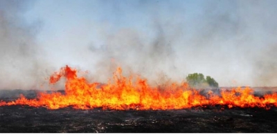
Significantly, since the last certification of the BFPL map, the NSW Government has introduced Vegetation Category 3, as outlined in the Planning for Bush Fire Protection 2019. This category pertains to grasslands and has been incorporated into the updated mapping for the Shire.
Mr. O’Mullane emphasized that the changes to the mapping do not hinder compliant development. “The changes don’t affect landowners unless they lodge a Development Application (DA) and/or Complying Development Certificate (CDC) Application for their property,” he explained. For areas identified as bush fire-prone, a site-specific bush fire risk assessment is necessary as part of the DA and/or CDC process.
These assessments are conducted by either Council staff or a Bushfire Planning and Design Accredited Practitioner. Following the completion of these evaluations, a Bushfire Attack Level is assigned to the development, which determines the necessary Bushfire Protection Measures. Such measures may include asset protection zones, access requirements, construction standards, siting and design considerations, landscaping, services, and emergency and evacuation planning.
The updated Bush Fire Prone Land map is available for public viewing at the following link: www.gunnedah.nsw.gov.au/index.php/development/landuse-planning/bushfire-prone-land. The revision of this map is a vital step in enhancing community safety and ensuring that development practices align with current environmental standards.