


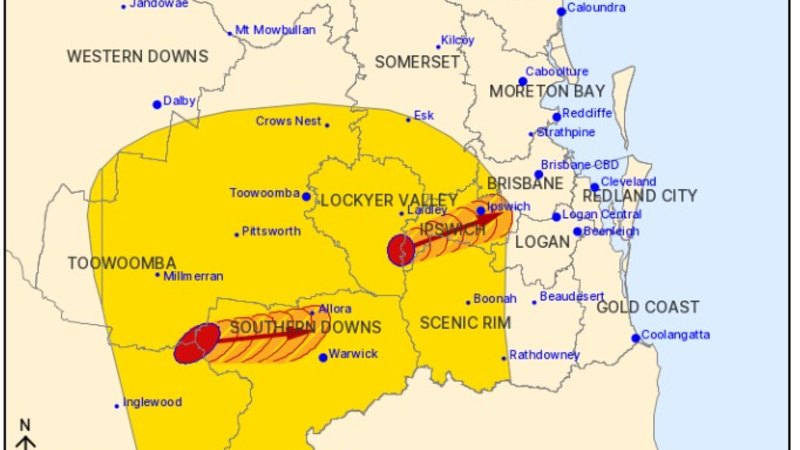
UPDATE: Severe thunderstorms are poised to hit South-East Queensland this afternoon, following a morning of clear skies. The Bureau of Meteorology (BoM) has issued an urgent alert, warning residents of hazardous weather expected to begin around 1 PM today.
Communities across the Gold Coast, Brisbane, Sunshine Coast, the Wide Bay and Burnett region, as well as Darling Downs and Warwick are at risk. Meteorologist Angus Hines cautioned that the storms could unleash a mix of severe weather conditions, including heavy rainfall that may lead to flash flooding, destructive wind gusts, and large hail.
“We could even see an outside chance of tornadoes touching down with the most severe thunderstorm cells later today,” Hines warned. Residents are urged to remain vigilant as strong winds could uproot trees and bring down branches, posing a significant threat to safety and property.
“Those trees can fall onto cars and houses, causing significant damage,” Hines added. “Dangerous travel conditions are likely, with flooded roads possibly isolating certain streets and locations.”
Authorities are urging everyone to prepare for the incoming storms. Flash flooding is a serious concern, particularly in low-lying areas. If you are in the path of these storms, ensure your safety by securing outdoor items and staying indoors during the worst of the weather.
The BoM has recommended that residents remain updated on weather developments throughout the day. Expect severe weather conditions to persist into the evening, with the risk of additional storms continuing. Stay alert, stay safe, and monitor local updates for the latest information.
This developing situation underscores the importance of being prepared for rapidly changing weather. With conditions expected to shift dramatically within hours, now is the time to take precautions.