


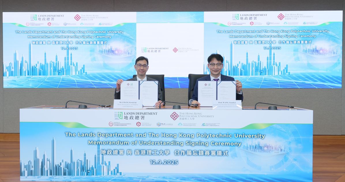
The Hong Kong Polytechnic University (PolyU) and the Lands Department of the Hong Kong Special Administrative Region (HKSAR) Government signed a Memorandum of Understanding (MoU) on March 15, 2024. This agreement aims to establish a collaborative framework that will enhance surveying, mapping, and geospatial services in support of Hong Kong’s digital transformation.
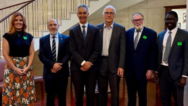
The signing ceremony took place at the PolyU campus, where key figures from both organizations were present. Among them were Prof. WANG Zuankai, Associate Vice President for Research and Innovation at PolyU, and Mr. CHANG Kwok-fai, Deputy Director of the Lands Department. Other notable attendees included Prof. CHEN Qingyan, Prof. CHEN Wu, and representatives from various departments within PolyU.
Strengthening Innovation and Efficiency
In his welcoming remarks, Prof. WANG emphasized the transformative potential of spatial data and artificial intelligence (AI) in urban planning and resource management. He stated, “By combining the authoritative expertise of the Survey and Mapping Office (SMO) with PolyU’s research excellence, this MoU will enhance Hong Kong’s status as a leader in smart city initiatives.”
Mr. CHANG echoed this sentiment, describing the partnership as a significant advancement in modernizing Hong Kong’s geospatial technologies. The collaboration aims to apply innovative solutions that will improve land administration efficiency and support the city’s development as a smart urban environment.
Under the terms of the MoU, four academic and research units at PolyU—including the Department of Land Surveying and Geo-Informatics (LSGI), the Research Institute for Land and Space (RILS), the Smart Cities Research Institute (SCRI), and the Research Centre for Artificial Intelligence in Geomatics (RCAIG)—will work closely with the SMO. Their collaboration will focus on interdisciplinary research, education, and knowledge transfer in various domains such as land surveying, geographic information systems, and AI technologies.
Joint Research and Training Initiatives
The partnership will also establish a joint research center that will merge PolyU’s academic resources with SMO’s professional insights. This center will explore a variety of advanced methodologies and technologies, including the Satellite Positioning Reference Station Network (SatRef) and unmanned aerial vehicles. The aim is to enhance the efficiency and accuracy of urban planning in Hong Kong.
Additionally, PolyU and the SMO plan to offer training programs for industry practitioners and government staff, focusing on the latest advancements in surveying and geospatial practices. Prof. CHEN Qingyan highlighted the need for interdisciplinary research to support Hong Kong’s sustainable development, stating, “Our goal is to translate research innovations into practical technologies that can significantly improve urban planning and land resource management.”
Prof. CHEN Wu added that the collaboration bridges the gap between theoretical research and practical application, ensuring scientific advancements are effectively utilized in addressing urban challenges. He remarked, “Together, we can leverage the strengths of both academia and government to create a smarter and more sustainable Hong Kong.”
This partnership signifies a strategic move towards integrating advanced surveying and geospatial innovations, fostering closer ties between academia, government, and industry. As both parties embark on this collaborative journey, the focus remains on enhancing Hong Kong’s capabilities in smart city development, ultimately improving the quality of life for its residents.