


The field of Geographic Information Systems (GIS) is undergoing a significant transformation with the introduction of artificial intelligence (AI) agents capable of performing GIS functions with minimal human involvement. A research team from Penn State University, published their findings in the Annals of GIS, detailing the development and testing of four AI agents designed to redefine GIS practices.
AI’s Role in Geographic Analysis
According to Zhenlong Li, the lead author and an associate professor of geography at Penn State, the integration of AI into GIS marks a new era. He describes this shift as moving beyond traditional tools, with AI acting as an independent “artificial geospatial analyst.” This new paradigm enables GIS systems to autonomously reason and innovate, addressing complex geospatial challenges more efficiently.
The study highlights the team’s efforts to establish a conceptual framework for autonomous GIS, focusing on how AI can be seamlessly integrated into existing workflows. Li stated, “Our goal is to lay the groundwork for the geospatial community to develop GIS systems that move beyond traditional workflows.” This transition aims to enhance the ability to derive and advance geospatial solutions.
Demonstrating Autonomy in GIS Agents
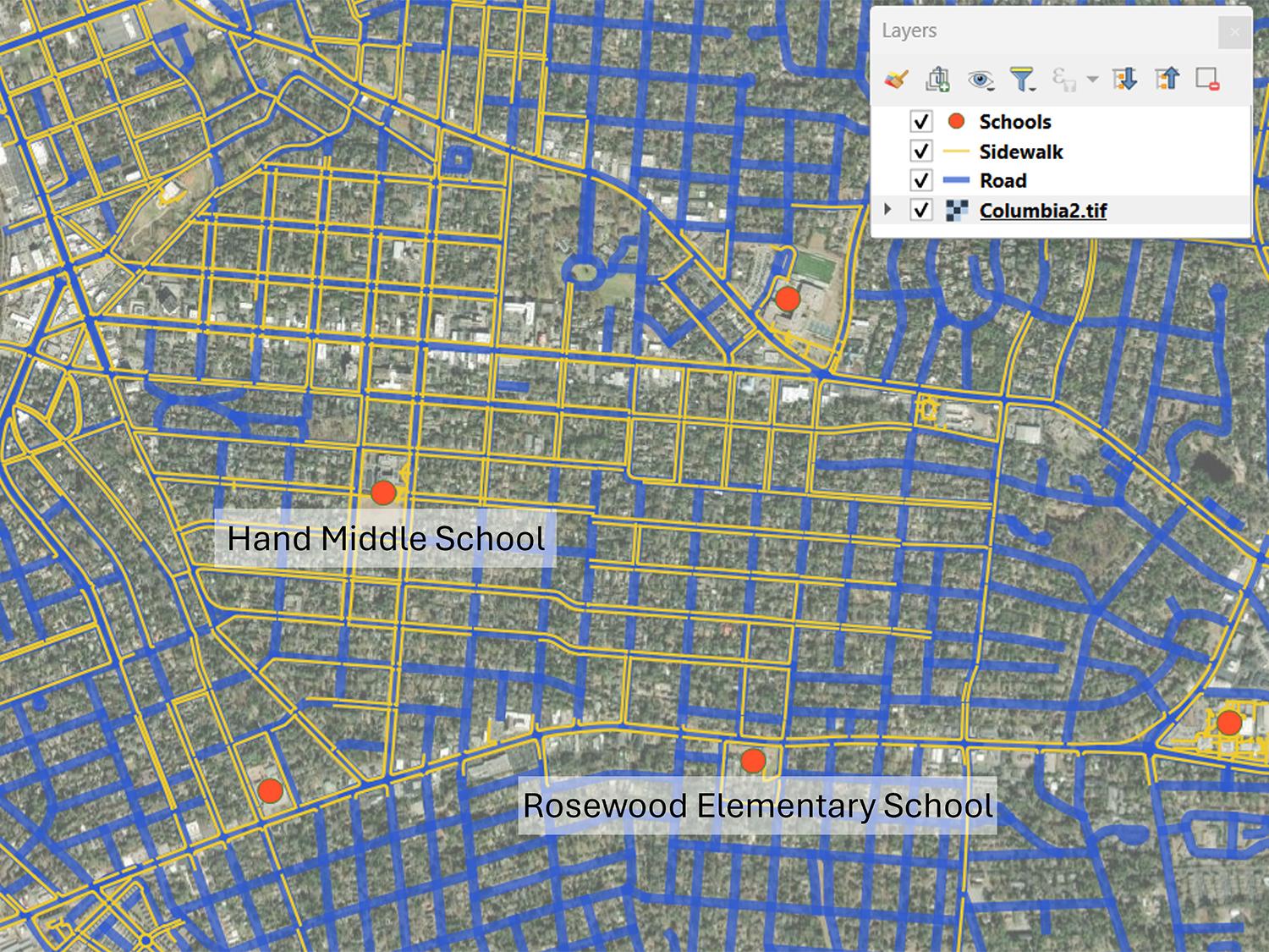
The researchers presented four proof-of-concept AI-powered GIS agents, showcasing their capabilities in retrieving data, performing spatial analyses, and generating maps with minimal human intervention. One notable example is LLM-Find, a data retrieval agent that automatically acquires geospatial datasets based on user requests. For instance, it can quickly obtain necessary data for assessing school walkability in Columbia, South Carolina, such as road networks and high-resolution imagery.
Li remarked, “LLM-Find demonstrated that autonomous GIS agents can handle data acquisition from sources without manual dataset hunting.” While LLM-Find significantly reduces the effort required for data preparation, it still relies on human oversight due to the limited number of sources it can consult.
The second agent, LLM-Geo, built upon LLM-Find’s capabilities by assessing school walkability using the retrieved data. It autonomously generated a spatial workflow that produced walkability scores and maps based on plain-language prompts. Li noted that this kind of analysis is typically undertaken by entry-level geographers, illustrating the potential for AI to take on more complex tasks.
In a further advancement, the researchers developed LLM-Cat, which tackled more intricate cartographic tasks. This agent went beyond data acquisition and analysis to design visual maps, making decisions about symbols, color scales, and map elements. This capability brings the system closer to achieving full automation in map production.
The implications of these AI advancements in GIS are significant. By reducing the manual labor associated with data preparation and analysis, professionals in the geospatial field can focus on more strategic tasks. As Li emphasized, the integration of AI into GIS workflows not only enhances efficiency but also opens new avenues for innovative problem-solving in various domains.
As the GIS community continues to explore these developments, the potential for AI agents to transform geographic analysis and decision-making processes remains promising. Researchers are keen to expand the capabilities of these agents, aiming for a future where autonomous GIS can address pressing challenges with greater speed and accuracy.