


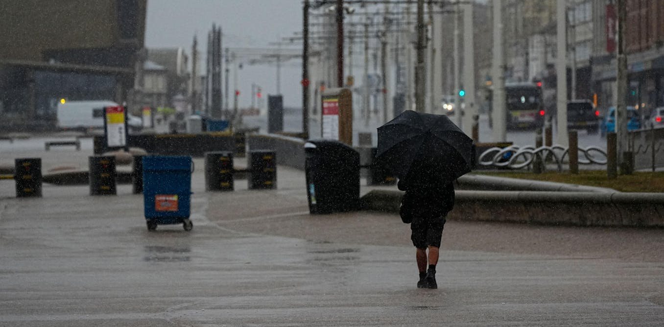
Storm Floris made landfall in northern parts of the UK on the morning of August 4, 2025, bringing heavy rainfall followed by severe winds. The Met Office issued an amber weather warning for much of Scotland, along with yellow alerts for parts of Northern Ireland and northern England. Areas affected can expect average rainfall of between 20mm and 40mm, with some regions in Scotland potentially receiving up to 80mm of rain. Wind speeds in exposed locations may reach between 80mph and 90mph, while gusts of 50mph to 60mph are forecasted for a broader area of Scotland.
The storm is notable for its unusually strong winds for August, a month typically characterized by less severe weather. This atypical timing raises concerns, as many people are outdoors during the summer, either traveling for holidays or camping. With trees still in full leaf, the risk of falling branches and downed trees increases significantly under high winds.
Authorities anticipate substantial disruption to transport and power networks, primarily due to the danger of falling trees. Recent research indicates that the risk of large power outages tends to increase during summer windstorms. Additionally, debris from fallen trees may obstruct drainage systems, leading to localized flooding. Persistent strong winds combined with heavy rainfall during the amber alert, which is set to expire at 23:00, will create challenging conditions for emergency responders.
Understanding Storm Floris
Storm Floris exhibits characteristics typical of a classic mid-latitude storm, which develops due to sharp temperature contrasts between the northern and southern Atlantic Ocean. These storms intensify under the influence of a strong jet stream, a fast-moving air current in the upper atmosphere that often directs storms toward the UK. Such conditions are unusual for summer months, when warmer Atlantic sea temperatures generally weaken these temperature gradients.
While storms like Floris are not common in August, notable examples from recent years include Storm Ellen, which caused extensive damage to electricity infrastructure in Ireland, prompting red and amber warnings from the Irish meteorological service. Other August storms have disrupted events such as the Boardmasters Festival in Cornwall in 2019 and affected stages at the Leeds Festival in 2024.
Storm Floris is classified as a Shapiro-Keyser cyclone, characterized by a warm core surrounded by colder air. This structure is evident in the storm’s frontal system, which wraps around its center, producing a characteristic comma-shape in satellite imagery. Such cyclones account for many of the UK’s most damaging wind events.
These storms often feature sharp pressure gradients and strong low-level airflows, particularly the cold jet, which can generate severe surface winds. While it appears that Storm Floris is unlikely to produce a sting jet—a rapid descent of air that can deliver damaging gusts—winds driven by the cold jet may still cause widespread disruption.
The Future of Storms Like Floris
Research suggests that climate change will impact the characteristics of storms such as Floris, although not all factors will be affected uniformly. Warmer temperatures are expected to result in wetter storms, as increased moisture in the atmosphere enhances rainfall, particularly along frontal boundaries. However, projections regarding wind extremes remain uncertain.
Climate models indicate a modest intensification of winter storms while suggesting a decrease in the intensity of summer storms. This implies that systems like Floris could become less frequent, largely due to anticipated changes in Atlantic temperature gradients and jet stream dynamics.
Despite these projections, many long-term climate models rely on lower-resolution data, which may not capture critical features driving storm intensification, such as the Gulf Stream and other factors contributing to extreme winds. Higher-resolution models, like those used in real-time forecasting for Storm Floris, predict more intense winter windstorms in a warming climate, primarily tied to stronger cold jets and a potential increase in storms capable of generating sting jets.
Although Storm Floris does not stem from tropical origins, it is a reminder that various storms can impact northern Europe during this season. The complexities surrounding the assessment of their risks remain an ongoing area of research.