


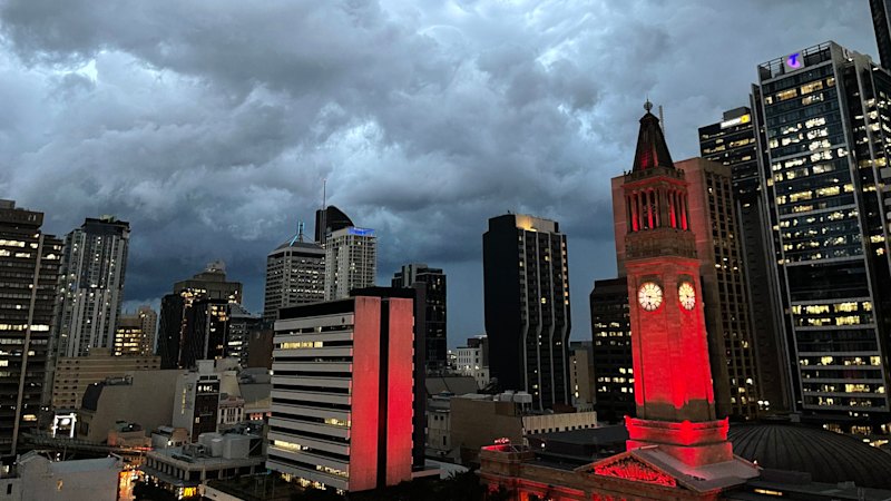
UPDATE: Brisbane residents are on high alert as the Bureau of Meteorology warns of potentially severe storms this weekend. Strong winds and large hail are expected to impact weekend plans across the region.
A high chance of showers and thunderstorms is predicted for Saturday afternoon and evening, with forecasters noting that these storms may be severe, featuring damaging winds and large hail. Senior forecaster Baden Gilbert confirmed that the storm risk encompasses much of the south-east region, extending from the coast west to Toowoomba and as far north as Rainbow Beach.
The Bureau of Meteorology cautions that the area facing the greatest threat includes the south-east interior, particularly around Boonah, Beaudesert, and the Lockyer Valley, which includes Ipswich, Kilcoy, and Esk. “There is a risk of very dangerous thunderstorms, with destructive wind gusts or giant hail not out of the question,” Gilbert stated.
The unsettled weather is attributed to a trough moving across the state’s southern interior, set to push into the south-east late on Saturday. If a significant storm cell develops, heavy rainfall could also occur, though moisture levels are currently low.
The trough is expected to move off the coast by Sunday, with the possibility of thunderstorms in the early morning along the coastal fringe. Following this potential storm activity, Gilbert indicated that residents can anticipate a drier week ahead. After a warm Saturday, temperatures will cool down on Sunday, but heat is forecast to ramp up again later in the week, with highs potentially reaching 35 degrees Celsius in Brisbane and 39 degrees in Ipswich by Thursday.
Residents are urged to stay informed and prepare for possible disruptions this weekend as conditions develop. This is a critical time for Brisbane, with the potential for dangerous weather impacting many lives. Stay tuned for further updates as the situation unfolds.